
Sprint – Monday, May 25th
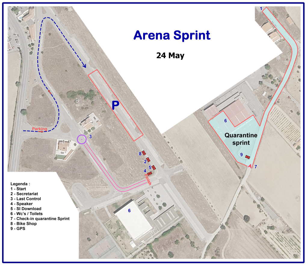
Arena
- Municipal Sports Gymnasium of Almeida (GPS: 40°43’02.9″N 6°53’50.5″W)
- Upon approaching the arena, there will be signage (orange and white arrows) for the parking lot, the quarantine area, and the arena itself.
- The event office at the arena is open from 8:30 – 13:00.
Parking
• The parking lot is near the arena.
Terrain
No roads will be closed to traffic, but not many cars are expected. However, please always pay attention to cars and people walking!
Urban terrain with high-speed roads and paths without significant obstacles, good visibility
Map
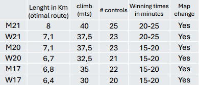
• Scale: 1:5000 / vertical contour interval 5 m
• Size: 29 x 35 cm
• double-sided, printed on water-resistant paper
• Mapper: Alexandre Reis
Course data
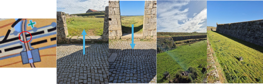
Warnings
- The competition partly takes place inside a fortress. Reading the map is essential as the high walls can only be navigated through limited passages, some under the walls.
- Some steps cannot be mapped; one specific step is recommended to be crossed on foot.
A marshal will be present to signal the hazard.
Quarantine zone / pre-start
• Distance from parking to quarantine zone: 400 m
• Check-in deadline quarantine zone: 10:00
• Receipt of GPS: Please be in quarantine at least 15 minutes before your pre-start time to have sufficient time to collect and fix the GPS device.
• Pre-start: It is located inside the start quarantine zone. Once athletes have passed the pre-start, they are not allowed to return. It is the athletes’ responsibility to be ready for their call-up time. Competitors who are late for their start time must use the corridor for late starters and must report to the start staff.
• A clock showing the call-up time will be displayed at the pre-start, and the competitors’ names will be called 5 minutes before their start time.
• Organisers will ensure bag delivery from quarantine to finish arena.
Start
• Individual start with an interval of 2 minutes.
• Distance from pre-start to start: 300 m. The route from the pre-start to the start will be marked by red-white stripes.
• Mandatory route of 120 m (marked by red stripes) from the time start to the point where orienteering begins. This map start will be marked by a flag in the terrain.