
Mixed Relay / Relay – Thursday, May 28th
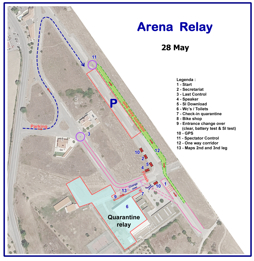
Arena
- Municipal Sports Gymnasium of Almeida
(GPS: 40°43’02.9″N 6°53’50.5″W) - Upon approaching the arena, there will
be signage (orange and white arrows)
for the parking lot, the quarantine area,
and the arena itself. - The event office at the arena is open
from 8:30 – 13:00
Parking
- The parking lot is near the arena.
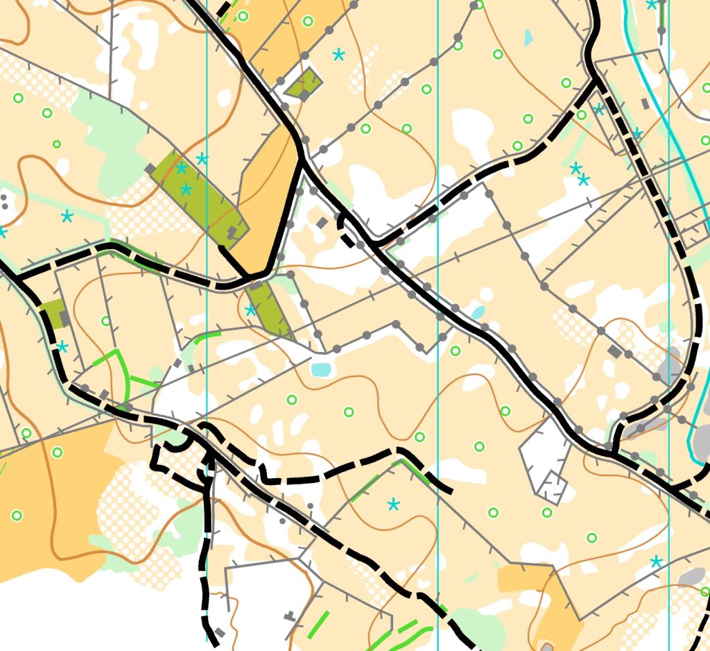
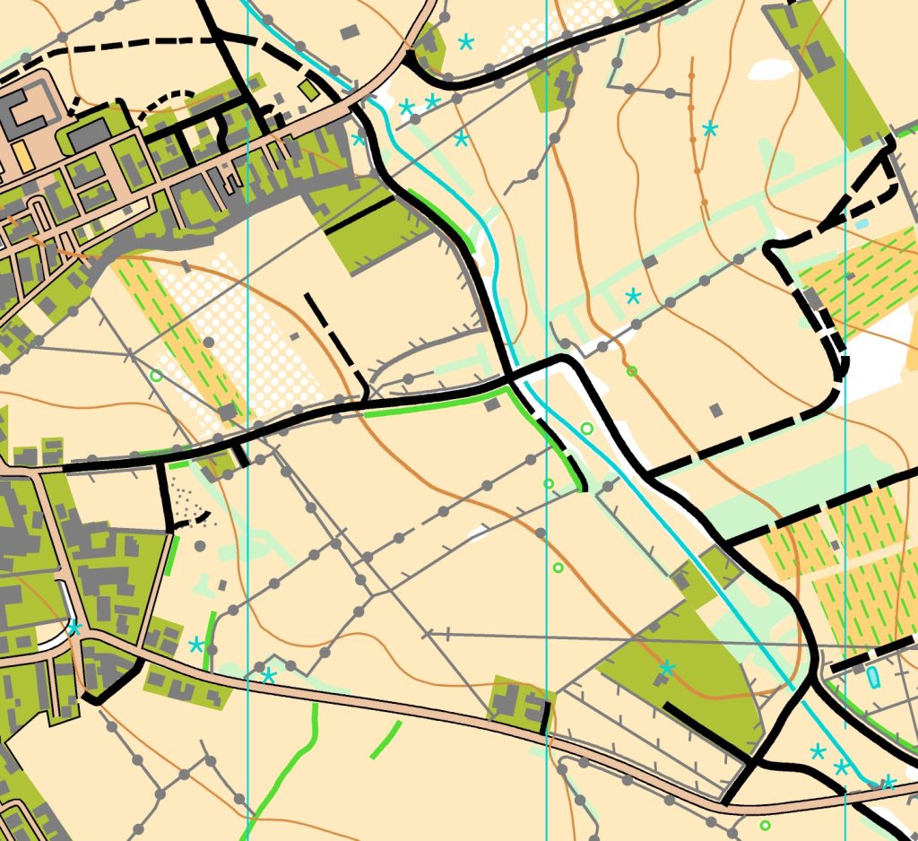
Terrain
- Vegetation consists of woods and cattle
grazing areas, where open areas
predominate. - The relief is low to medium.
- Good visibility and rapid progression
Warnings
- The responsibility for being ready to start the 2nd and 3rd leg of the Relay race rests with the athletes.
- The maps are located at the entrance to the changeover area, after the clear and check procedure.
- Athletes enter the changeover area after their team’s athlete has passed the spectator point.
- The final loop (from the spectator point to the changeover) has an approximate duration of:
- Mixed relay and M20 relay – 8 minutes
- W20, M17 and W17 relays – 4 minutes
Map
- Scale: 1:1000 / vertical contour interval 5 m
- Size: 32 x 41 cm
- printed on water-resistant paper
- Mapper: Alexandre Reis
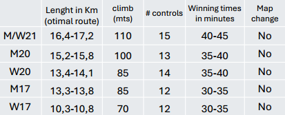
Course data
Quarantine zone / pre-start
- Distance from parking to quarantine: 200 m (Municipal Swimming pools of Almeida
GPS: 40°43’01.4″N 6°53’56.2″W). - Check-in deadline quarantine zone: 09:30
- Receipt of GPS: Please be in quarantine at least 15 minutes before your pre-start time to have sufficient time to collect and fix the GPS device.
- It is the athletes’responsibility to be ready for their call-up time. Competitors who are late for their start time must use the corridor for late starters and must report to the start staff.
- A clock showing the call-up time will be displayed at the start, and the competitors’ names will be called 5 minutes before their start time.
- Organisers will ensure bag delivery from quarantine to finish arena.
Start
- Details on the starting procedure can be found here.
- Mandatory route of 100 m (marked by red stripes) from the time start to the point where
orienteering begins. This map start will be marked by a flag in the terrain.